When I asked him, Tom guesses that we walked about 7 miles yesterday.
We headed over to Arches National Park and got there around 8:30 a.m. One thing I haven't mentioned yet in any blog is how enthusiastic and helpful every park ranger is. They're genuinely excited to help you get the most out of your trip, and they're all super knowledgeable about where you should go, where it might be too tough to go, and also other things (like what type of wildlife is what). We asked the park ranger at Arches what she would do if she had about five hours and she mapped out a gameplan for us, with two options depending on whether or not we wanted to do a strenuous 2-3 hour hike. Tom and I agreed that we could, but that doing what we've been doing on this trip -- seeing as much as we can -- meant not doing that and instead going to the end of the park and seeing some more arches. So we did that.
At the top of the park lay about seven main arches, at least three of which we saw: Tunnel Arch, Pine Tree Arch and Landscape Arch. Landscape Arch was one of the coolest arches in the whole park, hands down.
After those arches, the trail splits into tougher, more off-trail paths, and we decided not to go there because we'd be short on time elsewhere in the park. We turned around and headed back to where we were.
Then we saw a snake!
More views from the walk back.
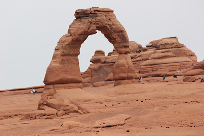
Our next stop was THE stop in the park: Delicate Arch. This is the arch found on Utah license plates. There were two ways to get here: the strenuous hike brought you right up to it, or there was a half-mile walk that you could see it from about a half-mile away.
Here's a view of how Delicate Arch fits in with its surroundings, with an extra shot of what I think are faces on the side of the rock:
One of our last stops was at another set of three arches: Turret Arch, North Window and South Window.
Turret Arch:
North and South Windows. (Note: it looks like an eagle!)
Some dudes sitting high atop a rock.
Our last major stop was at Balanced Rock. You can see why it's named as such.
We quickly grabbed lunch at Denny's (probably the worst meal I've had so far on this trip, but we had a coupon), then headed over to Canyonlands. We made a big purchase here: the National Park pass. It's $80 for a year for two people, but you don't have to pay admission to any park. Last week was fee free week, but we had to pay $10 to get into Petrified Forest & Arches. The park ranger told us that Bryce and Zion (where we're going the next two days) are both $25 entrance fees, as are (I think) Yellowstone and maybe one other. Factor in that we also had to pay to get into Canyonlands and that we're going to Death Valley and Joshua Tree, and I'm also going to Redwood and Glacier, and it was sort of a no-brainer.
The park ranger laid out a gameplan for us here, too, and the first stop was at Mesa Arch.
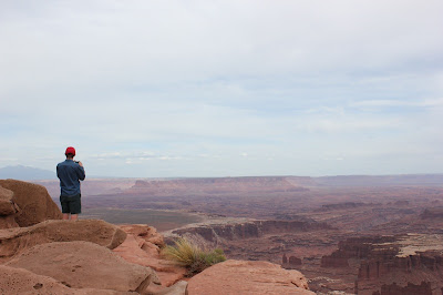
Next stop: Grand View Point Overlook. This place seemed almost more vast than the Grand Canyon. I'm not sure if it was or not. It's definitely far less deep, but I'm not sure about its overall size.
Totem Pole and Monument Basin:
I want this as a backyard, with a nice little waterfall in the middle leading down to a huge pool. Wouldn't that be nice?
Nice views.
We stopped next at Upheaval Dome. We're not sure what the actual Dome is, whether it's what we climbed or what we were looking at, but it was cool either way.
Last stop: Whale Rock. They said it was what we were climbing that was the Whale Rock, but I think this rock that we faced looks more like a whale:
Wiggly, windy road near the end. (We didn't have to drive this.)


No comments:
Post a Comment